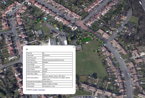
One of the most exciting advances in arboriculture and urban forestry is the ability to accurately map urban tree populations using GIS technology. This is something that I do on a regular basis for my clients using accurate GPS equipment to plot trees on streets, in parks and on housing land. Having a comprehensive map of your trees which links to specific information about each tree is a great starting point for good tree management. For clients that have their own GIS I can supply information in a compatible format and for those that don’t I can supply tree maps linked to Google Earth, like the screenshot below:
Whilst this information is great for tree owners to use for their own ends, there is a bigger picture and a greater need for better data on urban trees. If only we knew how many trees failed during storms of a particular ferocity. Or how the presence of trees is linked measures of well-being, health or affluence. This is where joined up thinking and the collection of more data could really advance our knowledge of trees and their benefits and/or issues.
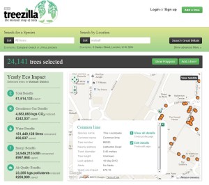
One recent project that is attempting to meet this need is ‘Treezilla’, the “monster map of trees”. This brilliant online resource contains a map of UK trees and uses methods developed by the iTree project in the USA to calculate ecosystem benefits that can be presented in pounds, shillings and pence (okay, not shillings). For example, a tiny part of central London, Victoria, has just 1200 trees. A detailed analysis of the area showed they remove 1.2 tonnes of pollution with a value £85,000 (on UK social damage cost basis) per year, they also attenuate 112,000 cubic metres of storm water with value of £50,000 per year (taken from the Treezilla website).
Anyone can log-in to Treezilla and add the details of trees. Why don’t you add a couple of trees from your street or garden? Access Treezilla at: http://treezilla.org/
If you’d like assistance in mapping your trees using GPS technology please contact Paul on 07765 493633 or email info@bartontrees.co.uk.


